Global alarm system watches for methane superemitters

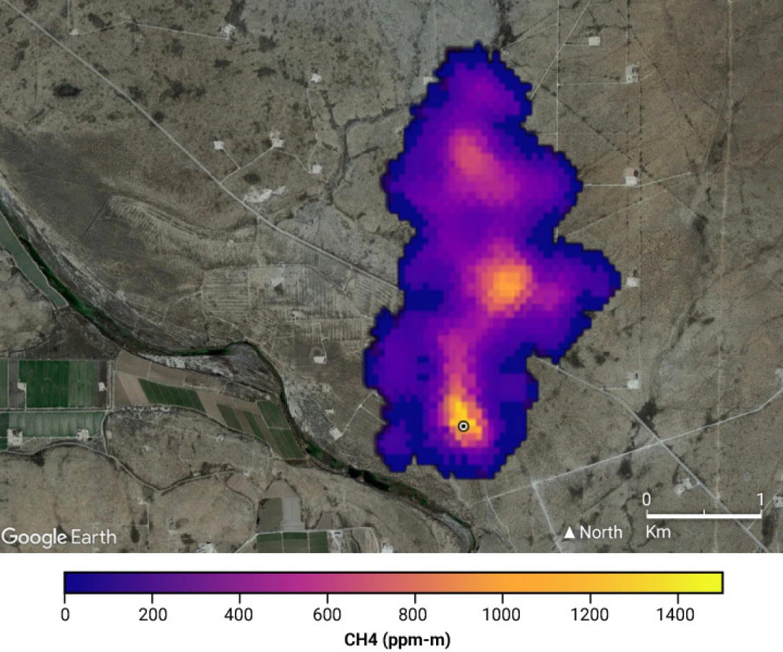
Methane is a stealthy greenhouse gas, erupting unpredictably from sources such as pipelines and gas fields. Scientists have wanted to catch these emitters in the act. In the past, watchdogs had to monitor likely sites from the ground or by airplane. Now, massive, short-lived leaks can be detected automatically, from space, anywhere in the world—a first step toward plugging them and slowing climate change.
The new technique, which uses artificial intelligence (AI) to scan through the 12 million daily observations collected by a European satellite, could aid future efforts to spot plumes in data collected by satellites, such as the International Methane Emissions Observatory announced in 2021 by the United Nations. Although so far the technique only captures the largest blowouts, there’s no better place to begin, says Ilse Aben, an atmospheric scientist at the Netherlands Institute for Space Research (SRON) and co-author of the new work. “That’s the low-hanging fruit,” she says. “If you’re putting in the effort to stop leaks of methane, better to start with the big ones.”
The SRON team behind the work, which appeared late last month as a preprint in the journal Atmospheric Chemistry and Physics, has now begun posting its weekly results on its website. Last month alone, they detected 192 methane plumes—some persistent, some intermittent—with an emissions rate greater than 10 tons per hour, concentrated in Asia but popping up on every continent except Antarctica.
Although methane in the atmosphere lasts for little more than a decade before decomposing, it is far more effective at trapping heat than carbon dioxide (CO2). Since 2006, atmospheric methane levels have grown some 7%, and the gas is responsible for roughly one-third of the 1.2°C of warming since preindustrial times. As the world approaches 1.5°C, the presumed threshold of “dangerous” warming, action to reduce methane releases has been seen as a way to buy a bit more breathing room to achieve longer term CO2 cuts.
In the past, researchers had to target locations already known to have methane releases to find new ones, says Riley Duren, a remote-sensing scientist at the University of Arizona and CEO of Carbon Mapper, a $100 million project that later this year will launch a pair of satellites designed to spot plumes of methane and CO2. The new technique, he says, “helps lay the foundation for future operational monitoring with the expanding global ecosystem of methane satellites.”
SRON’s automatic methane spotter relies on the Tropospheric Monitoring Instrument (TROPOMI) aboard the Sentinel-5 Precursor satellite, launched in 2017 as part of Europe’s Copernicus program of Earth observation. Designed to monitor atmospheric pollution, TROPOMI’s spectrometer has also proved capable of detecting the infrared glow of methane. Investigators began to use the spectrometer to monitor regions already known to be large methane sources. But Aben says they realized the satellite’s frequent global coverage should enable it to sound the alarm about any large methane releases.
The problem was the sheer volume of data, which made it hard to spot the plumes. Berend Schuit, a doctoral student at SRON, turned to AI for help. First he went through years of TROPOMI data, ending in 2020, identifying some 800 scenes of confirmed plumes, along with 2000 scenes without them. Armed with these scenes, Schuit and his colleagues trained their AI algorithm to recognize the plumes. But it spat out too many false positives, often caused by artifacts such as the stray edge of a cloud. Eventually, they were able to produce a reliable filter by training a second AI to spot signs that a result might be spurious, such as an increase in reflectivity from clouds in a scene, or an inconsistency between the wind direction and the path of a “plume.”
The team then tested the algorithms on TROPOMI’s measurements from 2021, finding 2974 unique methane plumes that they could confidently identify from just one satellite pass. More than 40% were associated with oil and gas development, another one-third with landfills, and 20% with coal mines.
TROPOMI’s roughly 5-kilometer resolution is not fine enough to spot the precise facility responsible for each plume. But data from future satellites should sharpen the pictures. This constellation will grow rapidly in the next few years, including with the launch of the Environmental Defense Fund’s MethaneSAT later this year, followed by Carbon Mapper and other satellites with even higher resolution.
Methane measurements from space have weaknesses, including difficulty distinguishing fresh plumes from gas already in the air, says Xin Lan, a carbon cycle scientist at the Earth System Research Laboratories of the National Oceanic and Atmospheric Administration. And much of the recent methane rise has come not from individual large emitters, but from more distributed sources, including tropical wetlands, which could be emitting more methane in response to warming. But this warning system is still welcome, Lan says. “The ability to detect emissions,” she says, “is the first step for action to reduce them.”

